
Bunurong Coast Woodlands
Wonthaggi to Inverloch Biolink/s
Connected Landscapes
Landholders across Bass Coast and South Gippsland are becoming more aware of the need to preserve depleting habitat on private and public land and connect these fragments of land to create wildlife corridors that will allow the free and natural movement of flora and fauna across these landscapes.
Project description
The focus of the project has been determined by combining data on local threatened species observations with existing vegetation maps, which highlight a clearly identifiable biodiversity hotspot. Lace Monitor, Koala, Swamp Skink and Swamp Antechinus can all be found persisting amongst patches of fragmented Damp Sands Herb-rich Woodland vegetation throughout the region.
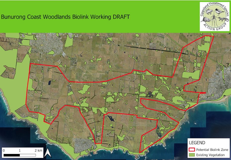
A patchwork of East-West linkages has been identified on the aerial map (above) from Wonthaggi to Inverloch, using both disused road reserves and remnant native vegetation on private land.
We are working with private landholders and public land managers throughout this zone to develop projects and apply for funding to expand habitat and connectivity with the support of local landholders.